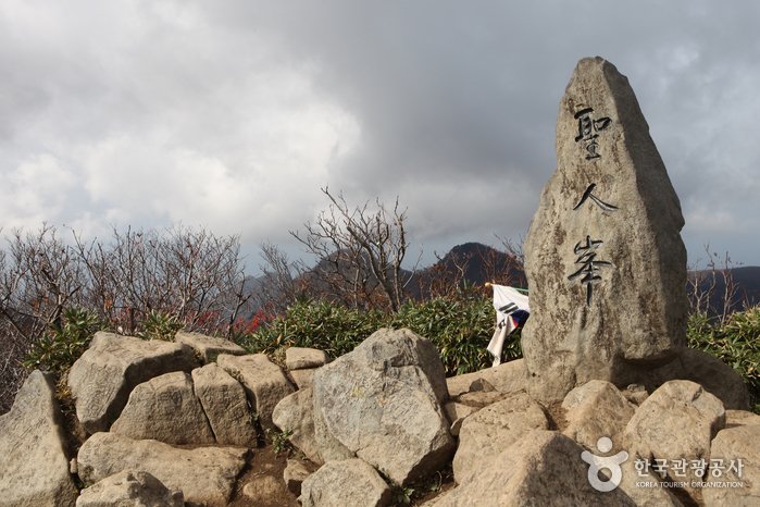
[Gyeongsangbuk-do] Seonginbong Primeval Forest [National Geopark] (성인봉 원시림 (울릉도, 독도 국가지질공원))
![Seonginbong Primeval Forest [National Geopark] (성인봉 원시림 (울릉도, 독도 국가지질공원))](https://tong.visitkorea.or.kr/cms/resource/57/2370057_image2_1.jpg)
Hello! Here is the detailed information for ‘Seonginbong Primeval Forest [National Geopark] (성인봉 원시림 (울릉도, 독도 국가지질공원))’.
💡 Overview
The foot of Seonginbong Peak is covered with thick primeval forests designated as Natural Monument No. 189. This forest is Ulleungdo Island’s only flat area with a diameter of approximately 2 kilometers. It is a caldera formed by volcanic activities and developed over time. The area has many rare plants only found in Ulleungdo Island.
📋 Detailed Information
| 📍 Address | Namyang-ri, Ulleung-gun, Gyeongsangbuk-do (Zipcode: 40236) |
|---|---|
| 📞 Phone | +82-54-790-6182 |
| 🌐 Website | ulleung.go.kr |
| Inquiries and Information | • 1330 Travel Hotline: +82-2-1330 (Korean, English, Japanese, Chinese) • For more info: +82-54-790-6182 +82-33-791-2113~4 |
📝 Additional Information
[Restricted Mountain Areas]
* Refer to the website.
[Hiking Course]
Daewonsa Course, KBS Junggyeso Course, Anpyeongjeon Course, Naribunji Course 1, Naribunji Course 2, Naribunji Course 3
[Mountain Not Access Period]
Seasonal Forest Fire Prevention Period
Spring: March 2 – April 30
Autumn: November 1 – December 15
* Periods and areas subject to change based on fire weather advisories, snow/precipitation levels, and other local conditions.
[Restrooms]
Available
📸 Gallery (Click to enlarge)
![Seonginbong Primeval Forest [National Geopark] (성인봉 원시림 (울릉도, 독도 국가지질공원))](https://tong.visitkorea.or.kr/cms/resource/23/1863023_image2_1.jpg)
![Seonginbong Primeval Forest [National Geopark] (성인봉 원시림 (울릉도, 독도 국가지질공원))](https://tong.visitkorea.or.kr/cms/resource/31/1863031_image2_1.jpg)
![Seonginbong Primeval Forest [National Geopark] (성인봉 원시림 (울릉도, 독도 국가지질공원))](https://tong.visitkorea.or.kr/cms/resource/32/1863032_image2_1.jpg)
![Seonginbong Primeval Forest [National Geopark] (성인봉 원시림 (울릉도, 독도 국가지질공원))](https://tong.visitkorea.or.kr/cms/resource/33/1863033_image2_1.jpg)
![Seonginbong Primeval Forest [National Geopark] (성인봉 원시림 (울릉도, 독도 국가지질공원))](https://tong.visitkorea.or.kr/cms/resource/34/1863034_image2_1.jpg)
![Seonginbong Primeval Forest [National Geopark] (성인봉 원시림 (울릉도, 독도 국가지질공원))](https://tong.visitkorea.or.kr/cms/resource/46/1863046_image2_1.jpg)
![Seonginbong Primeval Forest [National Geopark] (성인봉 원시림 (울릉도, 독도 국가지질공원))](https://tong.visitkorea.or.kr/cms/resource/54/1863054_image2_1.jpg)
![Seonginbong Primeval Forest [National Geopark] (성인봉 원시림 (울릉도, 독도 국가지질공원))](https://tong.visitkorea.or.kr/cms/resource/53/2370053_image2_1.jpg)
![Seonginbong Primeval Forest [National Geopark] (성인봉 원시림 (울릉도, 독도 국가지질공원))](https://tong.visitkorea.or.kr/cms/resource/56/2370056_image2_1.jpg)
![Seonginbong Primeval Forest [National Geopark] (성인봉 원시림 (울릉도, 독도 국가지질공원))](https://tong.visitkorea.or.kr/cms/resource/22/1863022_image2_1.jpg)
Source: Korea Tourism Organization
![[Gyeongsangbuk-do] Yecheon Astro-Space Center (예천천문우주센터)](https://en.koreatourinfo.com/wp-content/uploads/2026/04/img_1775912946_343.jpg)
![[Seoul] Uidonggyegok Valley (우이동계곡)](https://en.koreatourinfo.com/wp-content/uploads/2026/03/img_1774439728_131.jpg)
![[Chungcheongnam-do] Muchangpo Beach (무창포해수욕장)](https://en.koreatourinfo.com/wp-content/uploads/2026/04/img_1775823945_764.jpg)
![[Busan] Spaland Centum City (스파랜드 센텀시티)](https://en.koreatourinfo.com/wp-content/uploads/2026/04/img_1775135768_904.jpg)