[Gyeongsangbuk-do] Juwangsan National Park (주왕산국립공원)
Hello! Here is the detailed information for ‘Juwangsan National Park (주왕산국립공원)’.
💡 Overview
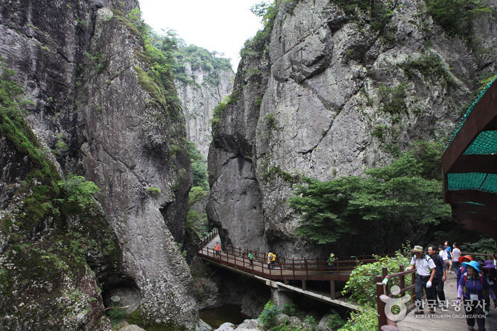
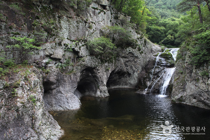
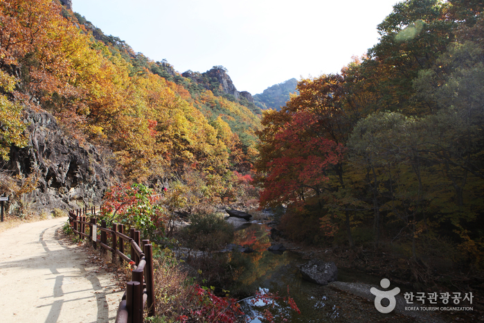
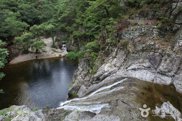
Juwangsan Mountain (alt. 720.6 m) is located in the Baekdudaegan Mountain Range, the backbone of the Korean peninsula. The mountain features deep valleys and many sheer rock cliffs to make it the third-largest rocky mountain in the country. Juwangsan Mountain was recognized as a tourist attraction on May 30, 1972, and became the 12th national park a few years later on March 30, 1976. The park is relatively small, filling in an area of just 105.582 ㎢ but it is great for a leisure walk with walking trails along the valleys up to waterfalls.
Juwangsan Mountain was called Seokbyeongsan Mountain during the Silla dynasty due to the many stone peaks jutting out but has been called Juwangsan Mountain since the Unified Silla period. In addition to these tall rocky peaks, Juwangsan National Park also includes four waterfalls, caves, Daejeonsa Temple, and other attractions for a comprehensive tourist site.
📋 Detailed Information
| 📍 Address | 169-7, Gongwon-gil, Cheongsong-gun, Gyeongsangbuk-do (Zipcode: 37437) |
|---|---|
| 📞 Phone | +82-54-870-5300 |
| 🌐 Website | juwang.knps.or.kr |
| Parking | Available (Sangui Parking Lot at the entrance of Juwanggyegok Valley) |
| Inquiries and Information | • 1330 Travel Hotline: +82-2-1330 (Korean, English, Japanese, Chinese) • For more info: +82-54-870-5300 |
📝 Additional Information
[Restrooms]
Available
📸 Gallery (Click to enlarge)

📍 Nearby Attractions
 Supullim (수풀림)Distance: 265m |
 Daejeonsa Temple (대전사) 🔗Distance: 481m | 226, Gongwon-gil, Cheongsong-gun, Gyeongsangbuk-do
- Three Falls of Juwangsan Mountain (주왕산 1.2.3 폭포) 🔗Distance: 1.8km | 24 Sangui-ri, Juwangsan-myeon, Cheongsong-gun, Gyeongsangbuk-do
Source: Korea Tourism Organization
![[Busan] Haeridan Street (해리단길)](https://en.koreatourinfo.com/wp-content/uploads/2026/04/img_1775136269_283-768x511.jpg)
![[Gangwon-do] Hwacheon Sancheoneo Ice Festival (얼음나라화천 산천어축제)](https://en.koreatourinfo.com/wp-content/uploads/2026/04/img_1775730918_721-768x432.jpg)
![[Chungcheongbuk-do] Goesan Historic House of Song Byeong-il (괴산 송병일 고택)](https://en.koreatourinfo.com/wp-content/uploads/2026/04/img_1775817702_600-768x512.jpg)
![[Busan] Baymond Hotel (베이몬드호텔)](https://en.koreatourinfo.com/wp-content/uploads/2026/04/img_1775216783_264.jpg)
![[Seoul] Giordano [Tax Refund Shop] (지오다노)](https://en.koreatourinfo.com/wp-content/uploads/2026/03/img_1774701102_240.jpg)