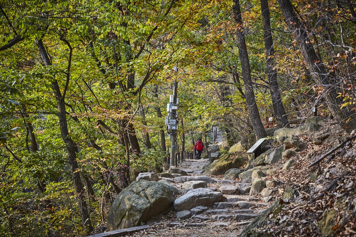
[Seoul] Bukhansan National Park (Seoul District) (북한산국립공원(서울))

Hello! Here is the detailed information for ‘Bukhansan National Park (Seoul District) (북한산국립공원(서울))’.
💡 Overview
Bukhansan Mountain was officially designated as a national park in 1983. Bukhansan National Park covers both Bukhansan and Dobongsan Mountains, and spans a total area of 80.699 ㎢. At the top of Bukhansan Mountain are Baegundae Terrace (835.6 m), Insubong Peak (810.5 m) and Mangyeongdae Terrace (799.5 m), which gave the mountain the nickname “Samgaksan” or the “three-horned mountain.” The mountain had other names: Sambongsan (mountain with three peaks), Hwasan (flower mountain), and Buaak (mountain shaped like a person giving a baby a piggyback ride). The current name, Bukhansan, was given after the Bukhansanseong Fortress was built under King Sukjong of the Joseon dynasty.
📋 Detailed Information
| 📍 Address | 262 Bogungmun-ro, Seongbuk-gu, Seoul (Zipcode: 02700) |
|---|---|
| 📞 Phone | +82-2-909-0497 |
| 🌐 Website | www.knps.or.kr |
| Day Off | * Subject to abrupt closure due to adverse weather conditions. |
| Parking | Available (Bukhansanseong Parking Lots 1 & 2, Jeongneung Parking Lot) |
| Inquiries and Information | +82-2-909-0497 |
📝 Additional Information
[Mountain Not Access Period]
Period of restricted access for fire-prevention and natural scenery maintenance, natural environment protection, and forest protection
[Hiking Trails]
Spring: March 2-April 30 / Fall: November 1-December 15
[National Park]
November 15-December 15 (Except Gyeongju & Taean shoreline)
* TBD by park directors based on fire weather advisories, precipitation levels, and other local conditions. Refer to the official website.
[Restricted Mountain Areas]
* Refer to the website (hiking.kworks.co.kr)
[Natural Preservation Areas (closed to public)]
* Jeongneung Ravine: Bottom of Cheongsupokpo Falls – Sujungbo – Neopjeokbawi Rock / Cheongsupokpo Falls – 30 m upper Cheongsucheon Stream / Bottom of Cheongsupokpo Falls – Jeongneung Ticket Booth Bottom: until 2026
* Insucheon Stream (Boundary between Hanilgyo Bridge – Jeonggyeongdae): until 2026
* Ui Ravine (200 m south of Ui Office – Former Baegun Ticket Booth): until 2026
* Gugi Ravine (Gugi Office – Shelter 4): until 2026
* Pyeongchang Ravine (Pyeongchang Ticket Booth 2 – Above Dongnyeongpokpo Falls): until 2026
* Sagimakgol Ravine Entrance – Bridge to an Army Base: until 2027
* Songchu Ravine (Songchu Railroad Bridge 1 – 3, Obong Three-Way Intersection): until 2026
[Restrooms]
Available
📸 Gallery (Click to enlarge)


📍 Nearby Attractions
 Jamunbak Cultural Festival (자문밖문화축제)Distance: 2.0km | 5 Pyeongchang 31-gil, Jongno-gu, Seoul
 Gana Art Center (가나아트센터)Distance: 2.0km | 28 Pyeongchang 30-gil, Jongno-gu, Seoul
 Total Museum (토탈미술관)Distance: 2.0km | 8, Pyeongchang 32-gil, Jongno-gu, Seoul
 Seoul Hwagyesa Temple (화계사(서울))Distance: 1.7km | 117, Hwagyesa-gil, Gangbuk-gu, Seoul
Source: Korea Tourism Organization
![[Gyeonggi-do] Puksuwon Spaplex (북수원온천)](https://en.koreatourinfo.com/wp-content/uploads/2026/04/img_1775304224_586-768x512.jpg)
![[Busan] Cheongsapo Daritdol Observatory (청사포 다릿돌전망대)](https://en.koreatourinfo.com/wp-content/uploads/2026/04/img_1775136613_101-768x512.jpg)
![[Busan] Busan Gamcheon Culture Village (부산 감천문화마을)](https://en.koreatourinfo.com/wp-content/uploads/2026/04/img_1775136654_281-768x512.jpg)
![[Seoul] Seongsunoru (성수노루)](https://en.koreatourinfo.com/wp-content/uploads/2026/03/img_1774870071_913-768x545.jpg)
3 Comments