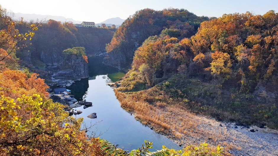
[Gangwon-do] Hantangang River [National Geopark] (한탄강(국가지질공원, 고석정))
![Hantangang River [National Geopark] (한탄강(국가지질공원, 고석정))](https://tong.visitkorea.or.kr/cms/resource/52/2675252_image2_1.jpg)
Hello! Here is the detailed information for ‘Hantangang River [National Geopark] (한탄강(국가지질공원, 고석정))’.
💡 Overview
Goseok Rock, located in the area of Hantangang River, is a granite rock that reach 15 meters in x_height. The area is often called Goseokjeong, named after the nearby Goseokjeong Pavilion. The area is an important geology and topography learning site where it is visible to see the topography before the formation of the basalt lava field and the fact that the basalt lava flowed over the bedrock to form the lava field. Goseok is a bedrock that existed before the area of Cheorwon was covered with lava, and is a granite formed underground about 110 million years ago (mid Cretaceous period). It is covered in basalt lava by volcanic activity that occurred between about 540,000 and 120,000 years ago, and then eroded by the Hantangang River to form a new waterway.
📋 Detailed Information
| 📍 Address | 1825 , Taebong-ro, Cheorwon-gun, Gangwon-do (Zipcode: 24023) |
|---|---|
| 📞 Phone | +82-33-450-4810 |
| 🌐 Website | www.hantangeopark.kr |
| Day Off | Security tour does not operate on Tuesdays and during Seollal (Lunar New Year’s Day) & Chuseok (Korean Thanksgiving Day) holidays |
| Inquiries and Information | • 1330 Travel Hotline: +82-2-1330 (Korean, English, Japanese, Chinese) • For more info: +82-33-450-4810 |
📝 Additional Information
[Admission Fees]
Free
📸 Gallery (Click to enlarge)
![Hantangang River [National Geopark] (한탄강(국가지질공원, 고석정))](https://tong.visitkorea.or.kr/cms/resource/54/2609754_image2_1.jpg)
![Hantangang River [National Geopark] (한탄강(국가지질공원, 고석정))](https://tong.visitkorea.or.kr/cms/resource/50/2675250_image2_1.jpg)
![Hantangang River [National Geopark] (한탄강(국가지질공원, 고석정))](https://tong.visitkorea.or.kr/cms/resource/51/2675251_image2_1.jpg)
📍 Nearby Attractions
 Hantangang River Jusangjeolli-gil (철원 한탄강 주상절리길(잔도))Distance: 1.7km | San78-2 Guntan-ri, Galmal-eup, Cheorwon-gun, Gangwon-do
 Goseokjeong Flower Field (고석정 꽃밭) 🔗Distance: 592m | 10-2 Jangheung-ri, Dongsong-eup, Cheorwon-gun, Gangwon-do
 Cheorwon Facilities Management Office (Formerly, Iron Triangle Battlefield (철원 시설물관리사업소 (구 철의삼각전적관)) 🔗Distance: 236m | 1825, Taebong-ro, Cheorwon-gun, Gangwon-do
 Sundamgyegok Valley (순담계곡) 🔗Distance: 1.5km | 143-3, Sundam-gil, Cheorwon-gun, Gangwon-do
 The 2nd Tunnel (제2땅굴(철원)) 🔗Distance: 89m | Yangji-ri, Dongsong-eup, Cheorwon-gun, Gangwon-do
 Goseokjeong National Tourist Area (고석정국민관광지) 🔗Distance: 228m | 1825, Taebong-ro, Cheorwon-gun, Gangwon-do
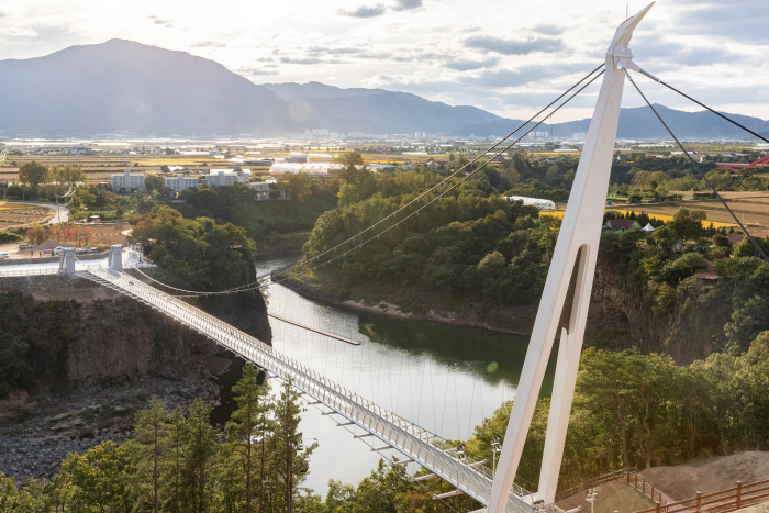 Cheorwon Hantangang Milky Way Bridge (철원 한탄강 은하수교) 🔗Distance: 1.8km | 725-12, Jangheung-ri, Cheorwon-gun, Gangwon-do
Source: Korea Tourism Organization
![[Busan] Kasina – Haeundae Branch [Tax Refund Shop] (카시나 해운대)](https://en.koreatourinfo.com/wp-content/uploads/2026/04/img_1775220402_548-768x576.jpg)
![[Busan] Apple Outlet – Busan Branch [Tax Refund Shop] (애플아울렛 부산)](https://en.koreatourinfo.com/wp-content/uploads/2026/04/img_1775219835_875.jpg)
![[Seoul] Harvad Eyewear [Tax Refund Shop] (하버드안경)](https://en.koreatourinfo.com/wp-content/uploads/2026/03/img_1774617208_157-768x512.jpg)