[Gangwon-do] Gongjaksan Mountain (공작산)

Hello! Here is the detailed information for ‘Gongjaksan Mountain (공작산)’.
💡 Overview
Gongjaksan Mountain, spreading out from the peak with an altitude of 887.4 meters, resembles the outstretched wings of a peacock (gongjak in Korean). Looking out from the top of the mountain, the entirety of Hongcheon County can be seen, as well as beautifully shaped cliffs spread throughout.
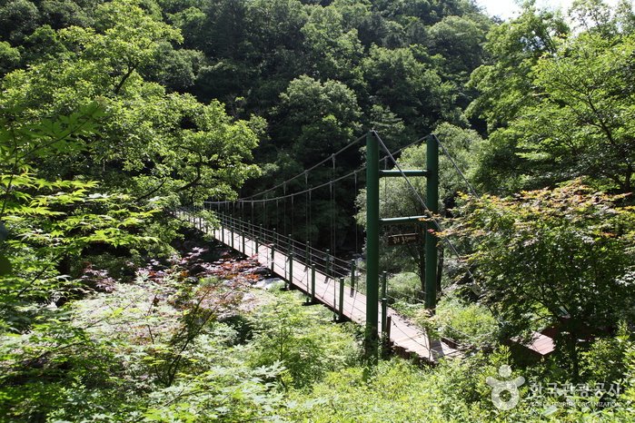
Sutagyegok Valley is very picturesque with wonderful rock outcrops and surroundings. This 8 kilometer-long valley links Sutasa Temple, which is about 6 kilometers lower than the peak, to Nocheon-ri.
Something for nearly every season with royal azalea flowers in spring, old pine trees and colorful foliage in fall, and snow-covered trees in winter, Gongjaksan Mountain’s beauty catches the attention of hikers year-round.
📋 Detailed Information
| 📍 Address | Hwachon-myeon, Hongcheon-gun, Gangwon-do (Zipcode: 25154) |
|---|---|
| 📞 Phone | +82-33-430-2791 |
| 🌐 Website | www.great.go.kr (Korean, English, Japanese, Chinese) |
| Day Off | N/A (Open all year round) |
| Inquiries and Information | • 1330 Travel Hotline: +82-2-1330 (Korean, English, Japanese, Chinese) • For more info: +82-33-433-1259 |
📝 Additional Information
[Mountain Not Access Period]
Annual Forest Fire Prevention Period
Feb 1-May 15 (Spring) / Nov 1-Dec 15 (Fall)
* The period is subject to change depending on weather conditions.
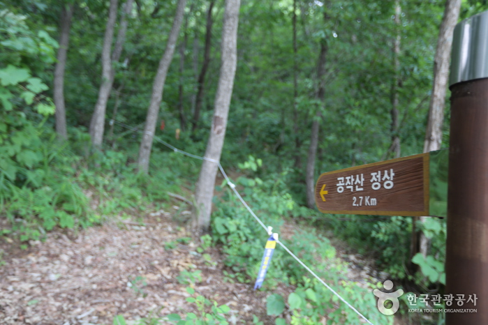
[Hiking Course]
* Top of Gongjakgogae Ridge → Ridgeline → Summit → Coming down from the ridge on the right (4km, 3 hr 30 min)
* Top of Gongjakgogae Ridge → Ridgeline → Summit → Water reservoir in Gulun-ri, Hwachon-myeon (5km, 5 hr)
📸 Gallery (Click to enlarge)
📍 Nearby Attractions
Source: Korea Tourism Organization
![[Gyeonggi-do] Hanwha Resort Yongin Besancon (한화리조트 용인 베잔송)](https://en.koreatourinfo.com/wp-content/uploads/2026/04/img_1775304597_645.jpg)
![[Seoul] Seoullo 7017 (서울로 7017)](https://en.koreatourinfo.com/wp-content/uploads/2026/03/img_1774347358_365.jpg)
![[Seoul] Mariang Plus – Konkuk Univ. Branch [Tax Refund Shop] (마리앙플러스 건대)](https://en.koreatourinfo.com/wp-content/uploads/2026/03/img_1774780350_143-768x432.jpg)
![[Incheon] ARTFACTORY CHARMGIROOM (아트팩토리 참기름)](https://en.koreatourinfo.com/wp-content/uploads/2026/03/img_1774878830_963-768x512.jpg)
![[Busan] Miko Jewelry – Shinsegae Centum City Branch [Tax Refund Shop] (미꼬쥬얼리 신세계센텀)](https://en.koreatourinfo.com/wp-content/uploads/2026/04/img_1775218459_343-768x576.jpg)
![[Seoul] Seoul Museum of Art (SeMA) (서울시립 북서울미술관)](https://en.koreatourinfo.com/wp-content/uploads/2026/03/img_1774527235_166-768x487.jpg)